OUR DEPLOYMENT OPTIONS
A Stable of Solutions.
One key attribute of marine operations is that the environment in which we work is forever changing. The tool that may be ideal for one application may not work at all in another. For this reason, SVG has developed a comprehensive stable of tools and methods to work in marine environments ranging from beach, to surf, to swamp, to rivers to open ocean. What these systems all have in common is that they provide the means to position and collect quality AGC data.
Please take a minute as we walk you through the process and show you the options we can offer.
Sidescan and Bathymetry.
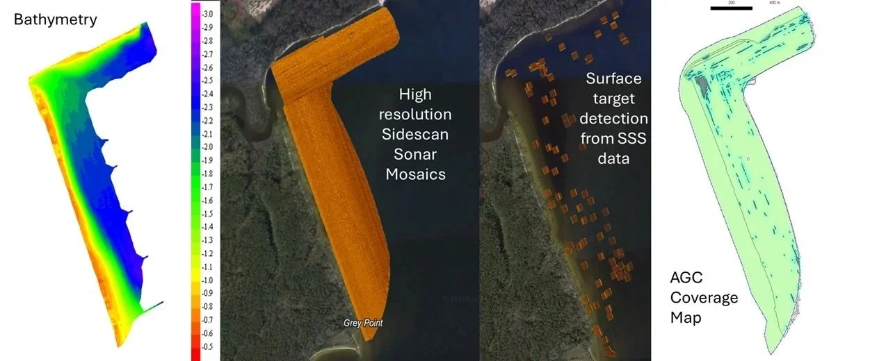
To record AGC data we must place an electromagnetic detecion array close to the seabed. Whether natural or manmade, the seabed is often littered with obstacles. Our equipment is designed to avoid these obstacles but we must first gain a very detailed understanding of what is present. To do this, before starting our AGC survey, we must first perform a detailed hydrographic survey of the seabed using both sidescan sonar imagery and bathymetry.
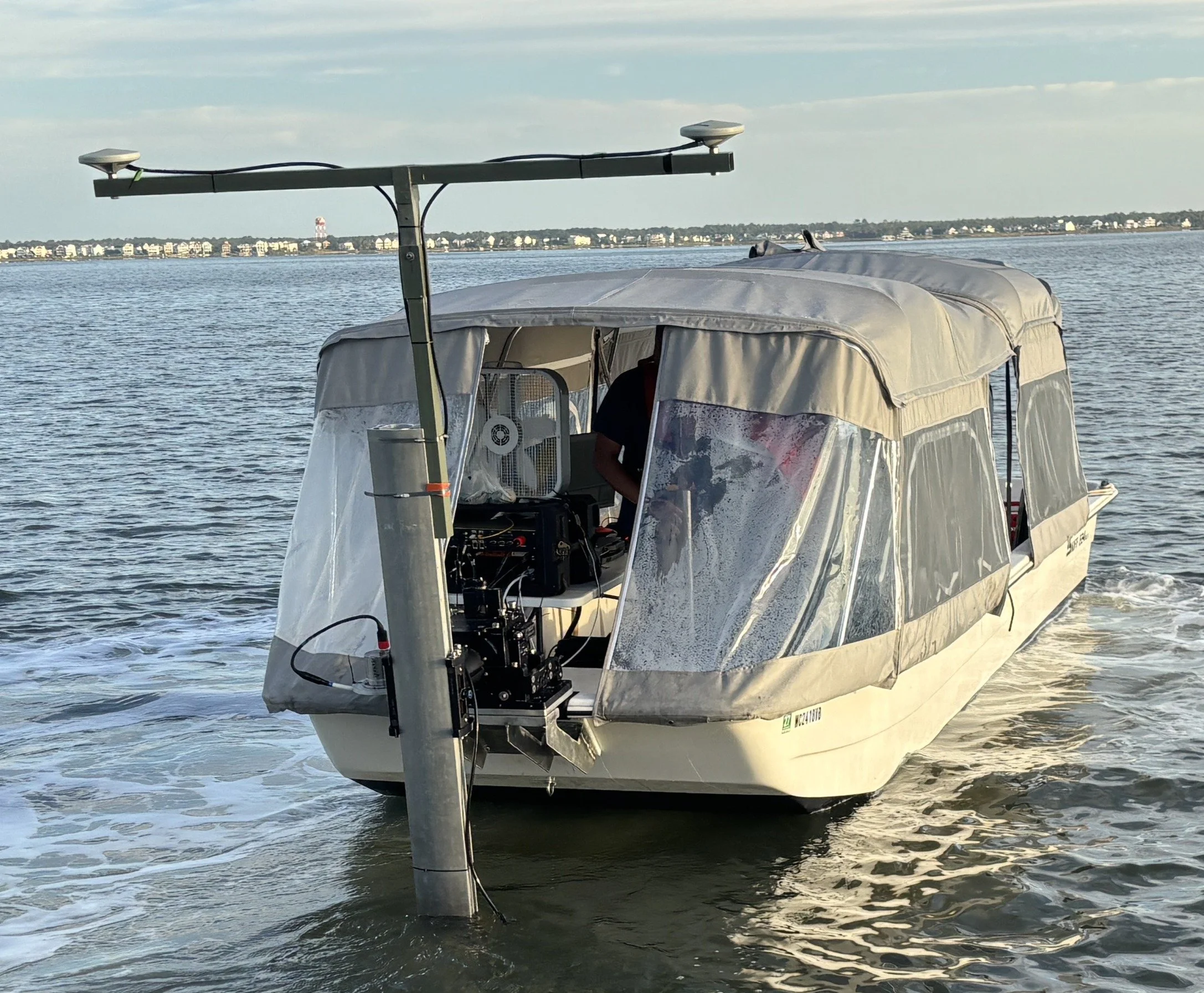
We have developed a very shallow draft acoustic survey vessel based on a 24ft Carolina Skiff. Providing shelter and a good work environment for the surveyors and many computers and electronics needed to perform a quality survey, this purpose built vessel allows us to efficiently collect high quality sidescan and bathymetric data in water depths of as little as 0.7m.
0.7m to 3.2m Water Depth
This is the water depth where the majority of our work is performed.
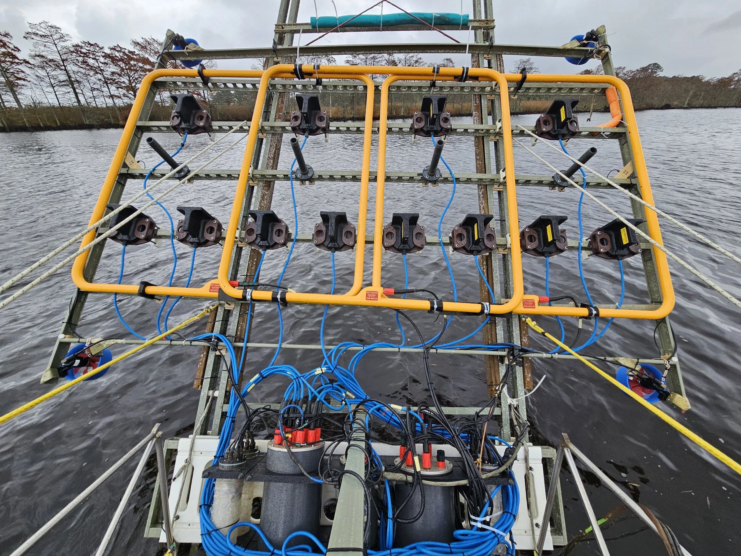
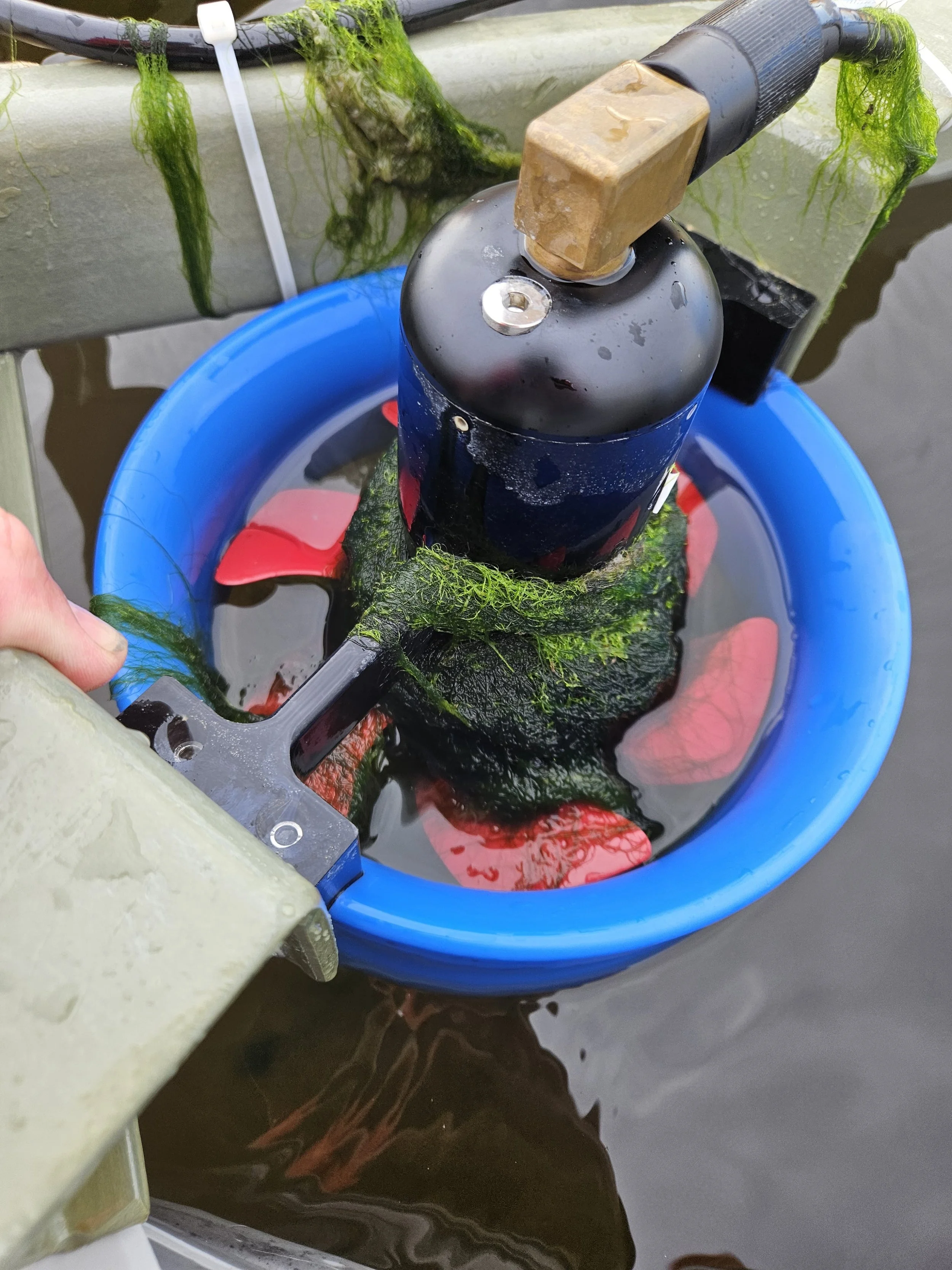
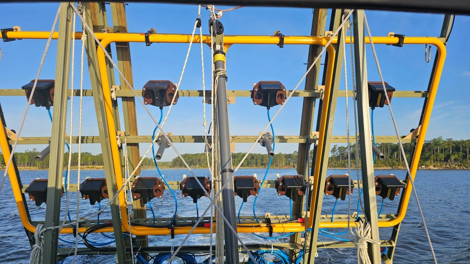
Building on our background in underwater robotics, SVG has developed an active towed array, which is a 3.6m swath towed array that uses thruster motors to stabilize the system and hold it at a nominal altitude above the seabed of around 0.5m. When we approach an obstacle identified during our sidescan/bathymetric survey, the array’s thrusters allow us to lift the array up and over the obstacle and drop back down to work, missing a minimal amount of area.
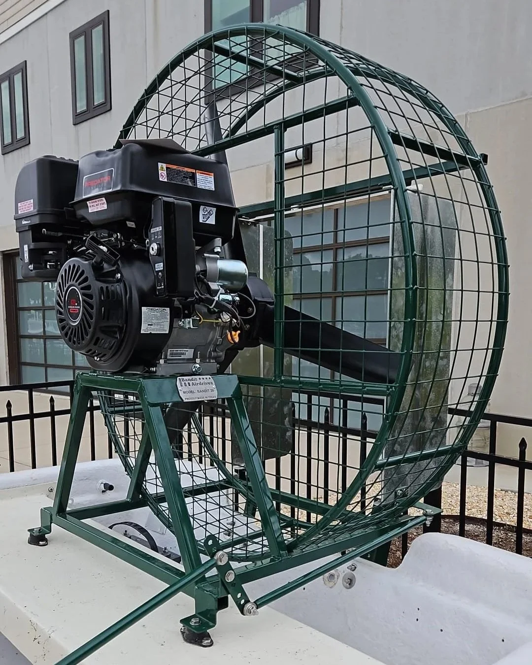
0.25 to 0.8m Airboat for heavy weed
Necessity is the mother of innovation. Thruster motors offer many advantages with control of the array, but they quickly foul on weed, which is often present when surveying in very shallow water. To work around this problem, our team developed our airboat for operating in very shallow waters where weed is a problem. By using an airdrive, we are able to efficiently shunt the array as it floats on the surface.
When operating in this configuration, the airboat positions the array while the GeoSearch, standing by in the vicinity, is able to record the data via an RF interface.
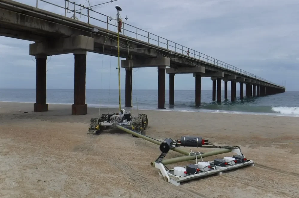
Beach to Surf
Presenting an environment where no boat can practically survey, while being a point where mobilized munitions are likely to aggregate, the surfzone of a beach is a very challenging environment to collect AGC data. To solve this problem, SVG developed the SurfROVer, which provides a powerful and stable platform for towing an AGC array through the surf while providing a platform stable enough to carry a tall mast for positioning purposes.
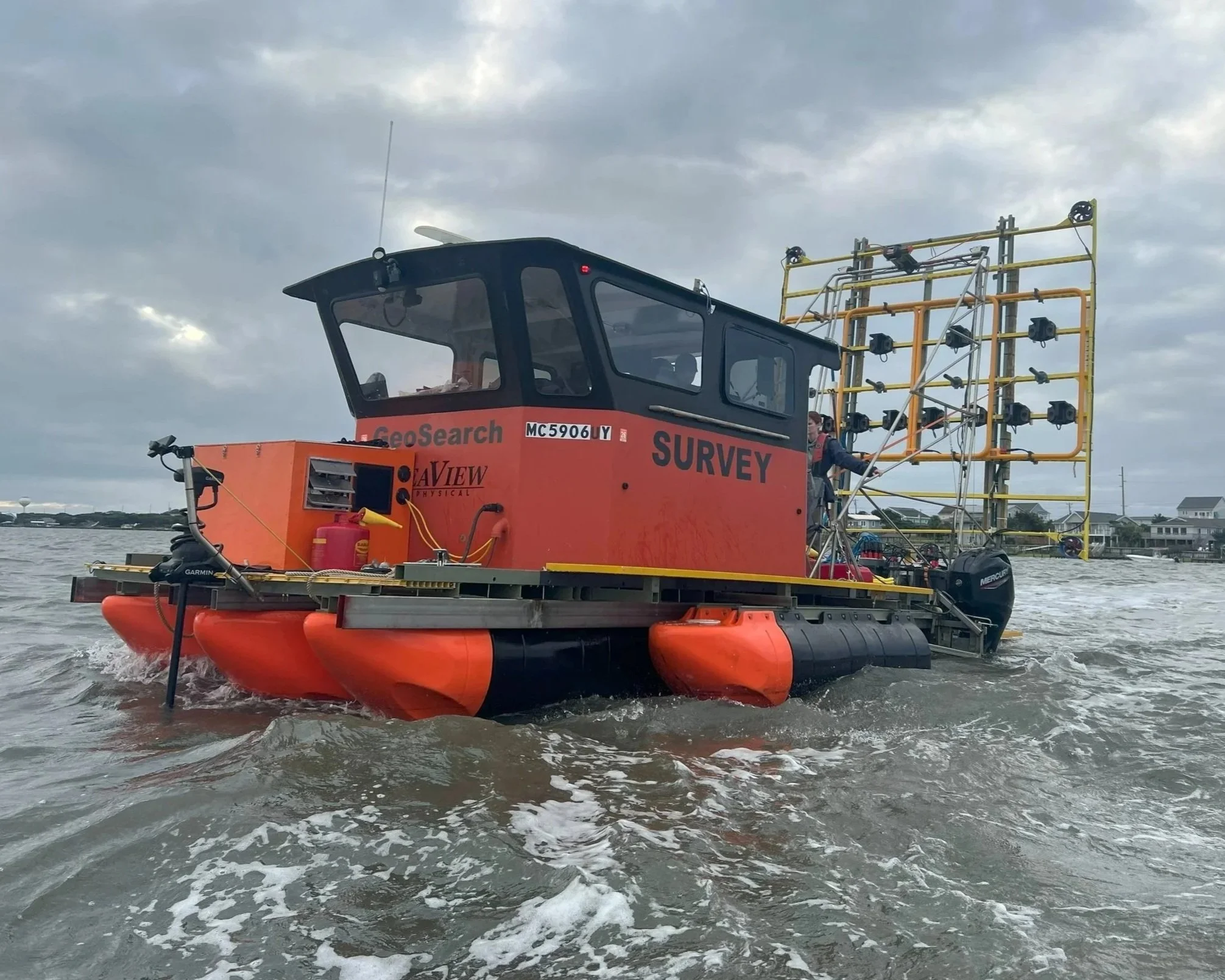
S/V GeoSearch
The GeoSearch is the workhorse of our operation. Able to operate in water depths as shallow as 0.7m, GeoSearch provides us with a stable platform for carrying and deploying the 3.6m wide active towed array. Equipped with dual 40 hp jet drives, station-keeping capability, clean power, a Starlink Internet connection, and a sheltered work environment, this unique vessel has supported the collection of over 300 acres of DAGCAP quality AGC data while repeatably demonstrating the capability in ideal conditions of collecting over 8 acres of high-quality AGC data in a single day.

Offshore/Deepwater capability
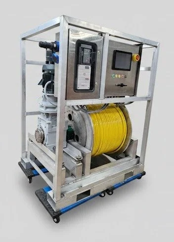
Inshore site surveys are a necessary and unique challenge, but much of the world’s UXO is in open waters. Underwater power cables are essential for transmitting power from offshore wind turbines. The cable routes must first be cleared of UXO. Once laid and buried, how do you determine the burial depth when the cable is meters below grade? You use the Marine UltraTEM IV. But how do you run an array 0.5m above the seabed when the vessel you’re towing from is heaving 2-3m in an open swell? You tow the array using a Heave-Compensated Winch. This remarkable system, developed in-house by SeaView Geophysical, uses a COTS heave compensation engine to measure the accelerations experienced as the tow vessel heaves in a seaway. It compensates for the heave by running the winch in and out in sync with the vessel’s heave, keeping the towed array unperturbed just off the seabed and maximising sensitivity. Light and easy to mobilize on most any vessel of opportunity, this system, along with our fly-away Active Towed Array, is the core of SVG’s rental pool. Contact us for details.